
River Navigation
Last Updated 7/12/2023
DISCLAIMER:
This page may not be 100% accurate as the river changes quickly. Please also pay attention to the river level as logs or trees may move or relocate with the high water levels and increased current. Please note the date last updated immediately below the page title.
This content is for informational purposes only; we hold no liability for your navigation of the river.
If you see a shallow spot or a sandbar that is not indicated on this page or see changes in the channel, please submit it here to inform page updates.

Going upriver can be scary, especially for new boaters to the Cedar who do not know the deep and shallow spots of the channel. This section shows you where the sandbars and shallow spots of the river may be, and the most common routes taken by boaters to avoid getting beached. Please read the disclaimer above.
The river is ever-changing, and boaters must keep a lookout for sandbars to avoid getting beached.
Quick Run-down of the River
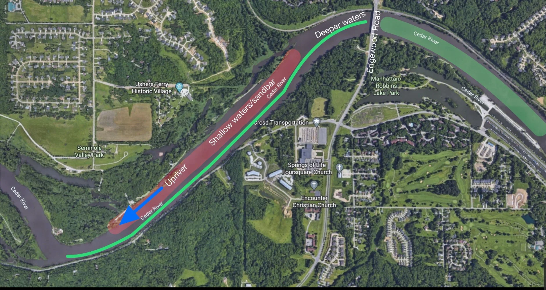
The Cedar River is full of sandbars and shallow spots. However, these shallow spots are usually only upriver from the Edgewood Bridge. Between Downtown Cedar Rapids and the Edgewood Bridge, there is not much worry about sandbars. Let’s take this upriver until about the Blairs Ferry Road bridge.
Edgewood Bridge
After the Edgewood bridge, it is advised to stay to the LEFT side of the channel (going upriver, right side coming downriver) as there is a large sandbar covering the middle and right side of the channel.
Turn After Edgewood
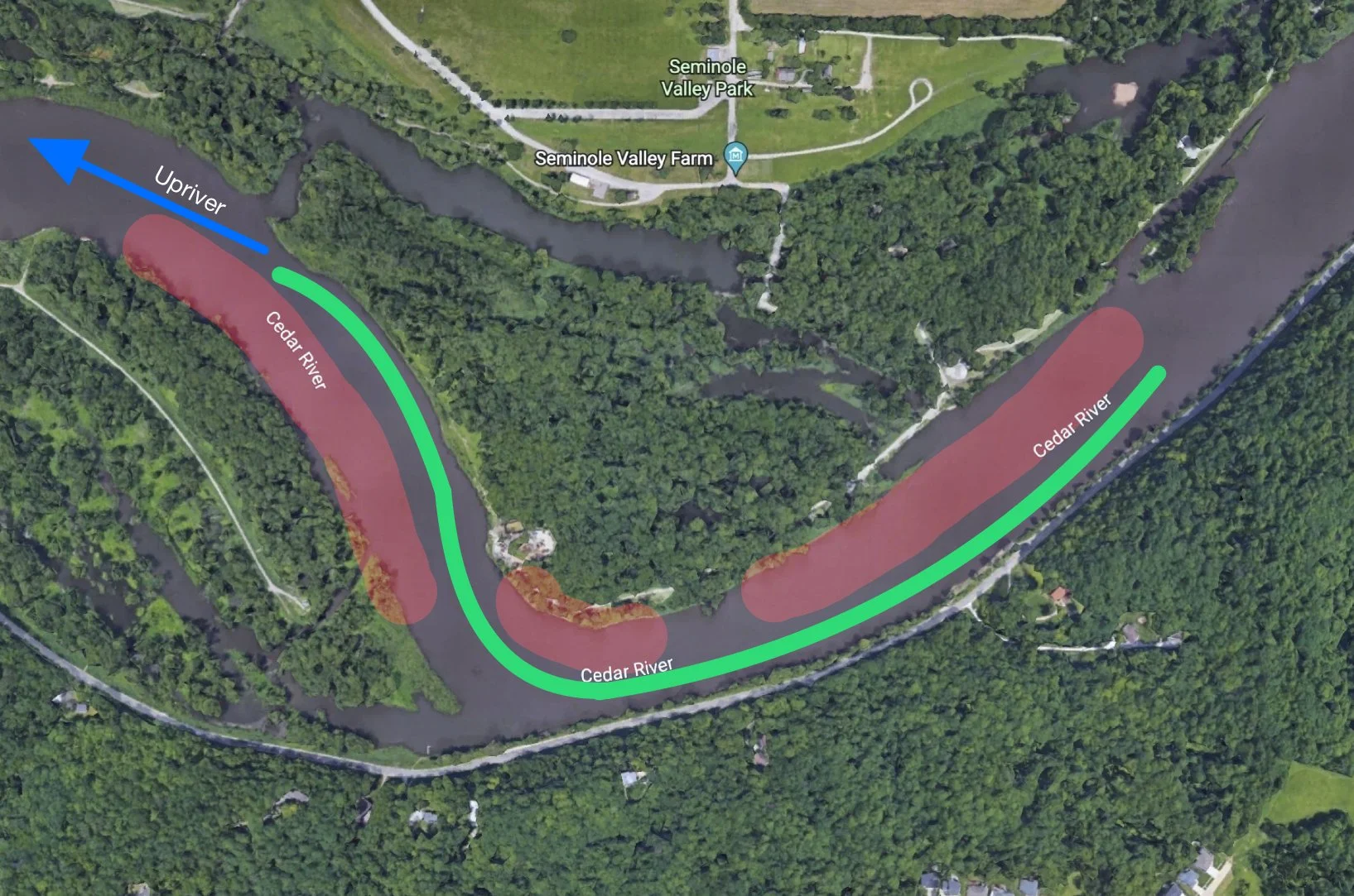
At this curve going upriver, you will be on the left side of the channel from the previous guide. For this turn, you will want to hook to the right side of the channel after the curve, however, be careful as there is a small beach right on that corner; it can catch you off guard.
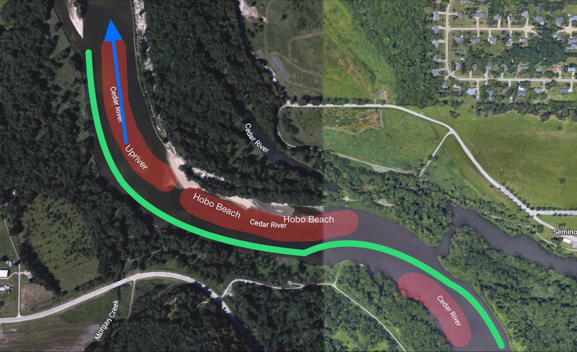
Hobo Beach turn
When you approach Hobo Beach, you will be on the right side of the channel from the previous guide. For this, will you split between Hobo Beach and the beach just before it on the left side of the channel (going upriver). Hook to the left of the channel right before Hobo Beach and keep left.
When you approach the second turn/curve to the right towards Pillars and Cowpie beach, you will want to stick to the far left of the channel, as there is a huge sandbar in the middle of the channel.
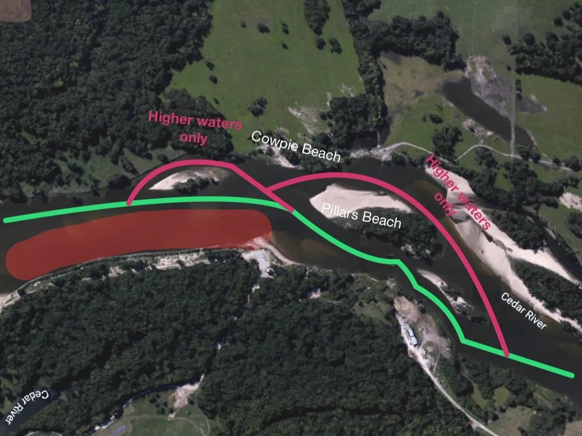
Pillars & Cowpie Beach area
When you’re approaching Pillars and Cowpie beach, there is a small unnamed island beach just before it. When the water level is low, you will want to stick to the right side of that island but stay as far left to the channel as possible. When the water is higher, you can make it through the left side of the island, along with Pillars. The waters on the right side of the channel before the pillars are extremely shallow as of 2023.
Pillars Beach is also an island; however, it is very shallow on the left side of it (going upriver), and the current runs through the right side. You will want to immediately hook to the right of the channel just before Pillars Beach and go through the pillars and come out the right side of another island just after the pillars.
Before Highway-100 Bridge
The area just after Pillars Beach is generally clear until the HWY-100 Bridge. There is another set of pillars before the bridge.
Highway 100 Bridge
When you go under the HWY-100 bridge, you will want to go under the right side of the railroad track bridge and the highway bridge. When you exit, you will want to stick toward the middle of the channel. Off your right will be Happlechute, a path that is only accessible when the water level is very high.
After Highway-100 Bridge
After the bridge, stick to the middle of the channel until you approach the next right-hand turn (going upriver). Hook to the left of the channel at this turn, and you will go through a little channel that is deeper than the main channel on the left side. When you exit, hook to the right side of the channel.